top of page


|
|
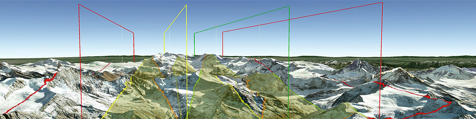
Manage your aerial survey mission
TopoFlight is the most efficient 3D flight planning software
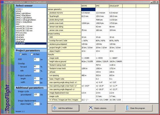
TopoFlight CamCulator
TopoFlight CamCulator is an efficient tool to compare different cameras regarding there usability for a certain project. Using a minimal set of data, e.g. ground sampling distance, requested overlaps and project extent, TopoFlight Camculator calculates all important flight parameters, e.g. height above ground, footprint of the images, airbase, number of lines, number of images, etc. for every mayor aerial camera systems, e.g. ADS40, DiMAC, DMC, RC30, UltraCam.
In addition, the list of cameras can be easily extended by the user.
And the best... the tool is fully free of charge. So try it.
bottom of page