top of page


|
|
|
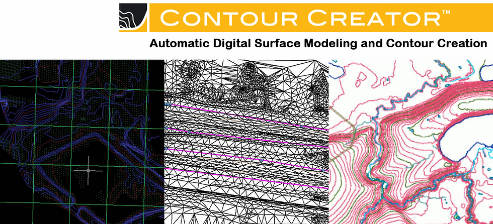
Product Description
Contour Creator generates and stores permanent contours into CAD or GIS drawings or vector interchange files. Once editing of the terrain model is complete, Contour Creator will generate elevation contours, smooth and symbolize the resulting lines, and place them in their appropriate database category.
Key Features
-
Accepts input from many industry standard point file formats and accepts multiple input formats at one time.
-
Allows user to select specific layers or levels from active AutoCAD®, MicroStation®, or ArcGIS®.
-
Allows selection of layers or levels from the reference files in AutoCAD and MicroStation.
-
Essential tools such as automatic depression contour identification, TIN- or grid-based calculations, and contour exclusion removal.
bottom of page